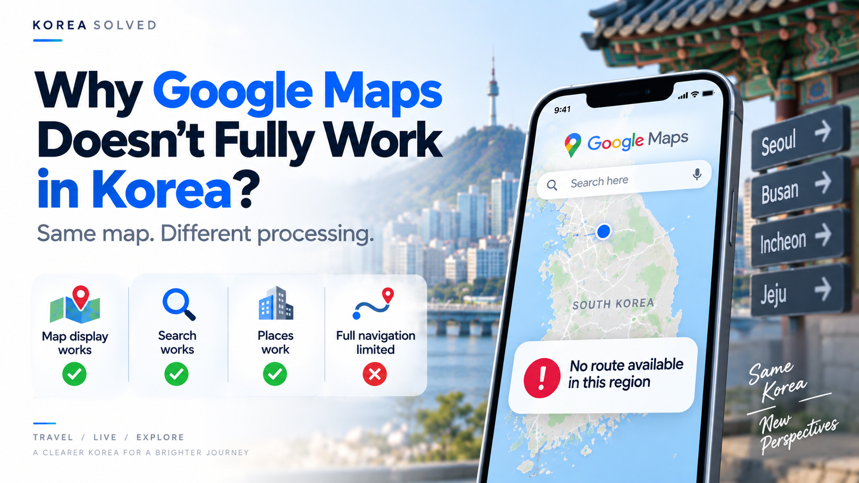
If you normally use Google Maps everywhere you travel, South Korea can feel confusing at first.
You open the app and everything seems normal. Streets are visible. Your hotel is there. Restaurants, cafés, subway stations, and tourist attractions all appear on the map.
Then you try to use Google Maps the way you normally would — especially for walking directions or turn-by-turn driving navigation — and the experience suddenly feels different.
So the obvious question is:
If Google Maps can show the map, why can’t it navigate normally?
The answer is more complicated than “Google Maps doesn’t work in Korea.”
Google Maps has long been able to display Korean roads and places. The main issue has historically been how Korea’s 1:5,000-scale map data could be transferred and processed for full navigation.
And in 2026, an important part of that situation changed.
But that does not mean Google Maps instantly became identical to the version you may be used to in other countries.
Does Google Maps Actually Work in Korea?
Yes.
Google Maps does work in South Korea.
You can still use it for many familiar tasks, including:
- searching for hotels, restaurants, and attractions
- viewing roads and locations
- saving places
- reading reviews
- checking some public transportation information
So saying that Google Maps simply “doesn’t work in Korea” is not quite accurate.
The biggest difference has historically been full navigation, especially walking directions and turn-by-turn driving guidance.
That is why Google Maps can look completely normal until you actually try to use it to get somewhere.
If the Map Is Visible, Why Can’t It Navigate Normally?
This is where many travelers get confused.
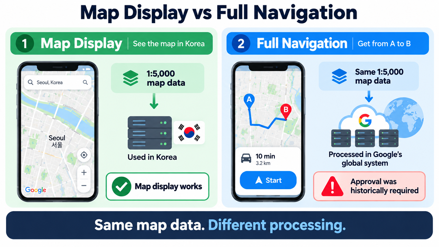
Showing a map and calculating a route are two different jobs.
Think of a paper map.
You can look at it and see roads, buildings, and places. But the map itself does not automatically calculate:
- which street you should take
- where you should turn
- which route is fastest
- whether a road is suitable for walking
- how current traffic conditions affect your trip
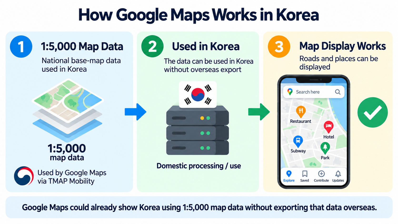
Google says its Korean Maps service has already been able to display map information using 1:5,000-scale map data from TMAP Mobility. This basic map-display service can operate without exporting the underlying TMAP data overseas.
Full route calculation is different.
According to Google, navigation requires much more computing power than simply displaying a map. Google’s routing system uses computing infrastructure distributed across data centers around the world.
Historically, using the same Korean 1:5,000 map data within that global routing system required approval for the relevant data to be transferred outside Korea.
The simplest way to understand it is:
Google could show the map.
The harder part was using the same 1:5,000 map data inside its global system for full navigation.
So Did Google Actually Have Korean Map Data?
Yes.
Google was not operating with an empty or extremely basic map of Korea.
Google says the Korean version of Google Maps already uses 1:5,000-scale map data from TMAP Mobility for map display. NAVER Map and KakaoMap also use the same general scale of national base-map data.
So the issue was not simply:
“Google did not have a map of Korea.”
A more accurate explanation is:
Google could use Korean 1:5,000 map data to display roads and places, but historically could not use that same data within its global routing infrastructure in the same way it does in many other countries.
That is why the map could appear normally while full navigation still felt incomplete.
Was This a Rule Specifically Against Google?
No.
This is important because the issue can easily be misunderstood.
South Korea’s map-data export rules were not written specifically for Google, nor were they based simply on whether a company was Korean or foreign.
The central issue was whether covered Korean geographic data would be transferred and processed outside the country.
A Korean company attempting the same type of overseas transfer would also have to comply with the relevant legal and security framework.
So it is more accurate to describe the issue as a map-data export and security policy, rather than a rule designed specifically to block Google.
Then Why Do NAVER Map and KakaoMap Work Better?
That naturally leads to another question:
If the rules apply broadly, why can NAVER Map and KakaoMap provide more complete navigation?
The key difference is largely where and how the data is processed.
Domestic mapping services can operate their routing systems inside Korea while using Korean mapping information under Korean rules.
Google Maps has historically relied on a global routing infrastructure that uses computing resources outside Korea.
So the difference is better understood like this:
NAVER and Kakao can process the relevant mapping data domestically.
Google wanted to use the same data within its global navigation infrastructure.
If the names are unfamiliar, NAVER is one of South Korea’s largest homegrown internet companies. Kakao is another major Korean technology company and is best known internationally for KakaoTalk.
This difference in data handling and system architecture is one major reason local map apps have historically been able to provide more complete navigation inside Korea.
Why Did South Korea Restrict Overseas Transfer of Map Data?
The main concern was security and the handling of sensitive geographic information.
South Korea has long maintained rules governing the overseas transfer of certain national mapping data.
This was not simply a ban on Google Maps.
The issue was how geographic information — including information connected to sensitive locations — could be handled and processed outside Korea.
Google argued that the 1:5,000 data it requested was Korea’s standard national base map rather than the higher-precision 1:1,000 electronic map, and that the 1:5,000 data had already undergone government security review.
The Korean government nevertheless required additional security safeguards before allowing overseas transfer.
A neutral way to understand the issue is:
- Google wanted to use the map data in a form compatible with its global routing infrastructure.
- The Korean government wanted stronger controls over how sensitive geographic information would be processed and exposed outside Korea.
Could Google Just Build Its Own Map of Korea?
In theory, Google could collect and build more of its own mapping data.
But that would not automatically solve the problem.
Building a separate nationwide map database from scratch would require significant resources and constant updates as roads, buildings, addresses, and transportation networks change.
More importantly, creating mapping data yourself does not automatically mean that any covered or protected geographic information can then be processed overseas without complying with Korean rules.
The important point is:
Building the map yourself does not automatically remove the rules on overseas processing.
What Changed in 2026?
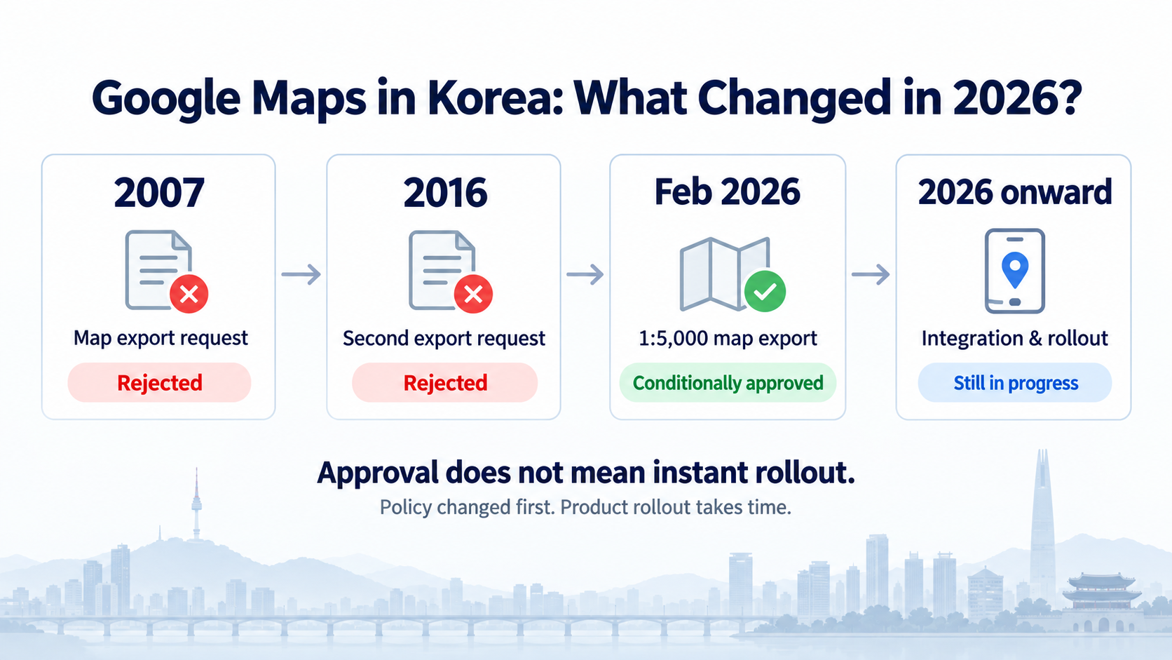
On February 27, 2026, South Korea conditionally approved Google’s request to export 1:5,000-scale map data.
The approval came with security conditions.
These included measures relating to sensitive locations, restrictions on certain coordinate information, and domestic processing requirements before permitted data could be transferred overseas.
So this was not a decision to let Google freely export Korea’s raw national map database.
It was a conditional approval designed to allow broader use while maintaining security safeguards.
If It Was Approved, Why Isn’t Google Maps Fully Fixed Yet?
Because government approval and a finished consumer service are not the same thing.
Approval removes one major policy barrier.
But Google still has to:
- process and integrate the data
- work with Korean partners
- adapt its routing systems
- test navigation quality
- roll out finished features to users
As of September 2026, travelers should still not assume that the complete Google Maps navigation experience available in many other countries is already available in Korea.
The easiest way to think about it is:
The policy changed first.
The product experience takes longer to catch up.
What Should Travelers Use Right Now?
Google Maps is still useful in Korea.
There is no reason to stop using it completely.
It can be especially convenient for:
- restaurants you saved before your trip
- hotels
- attractions
- travel lists
- reviews
- general trip planning
The problem comes when you expect Google Maps to be your only navigation app.
For actual day-to-day navigation inside Korea, it is still a good idea to install either NAVER Map or KakaoMap as well.
NAVER Map
NAVER Map is a major Korean map service and a strong all-around choice for:
- walking directions
- public transportation
- bus information
- subway navigation
- driving directions
- local place searches
KakaoMap
KakaoMap is another major Korean map service and is useful for:
- walking routes
- bus and subway directions
- local place searches
- driving routes
- people who already use other Kakao services
The simplest practical setup is:
Google Maps for planning.
NAVER Map or KakaoMap for navigation.
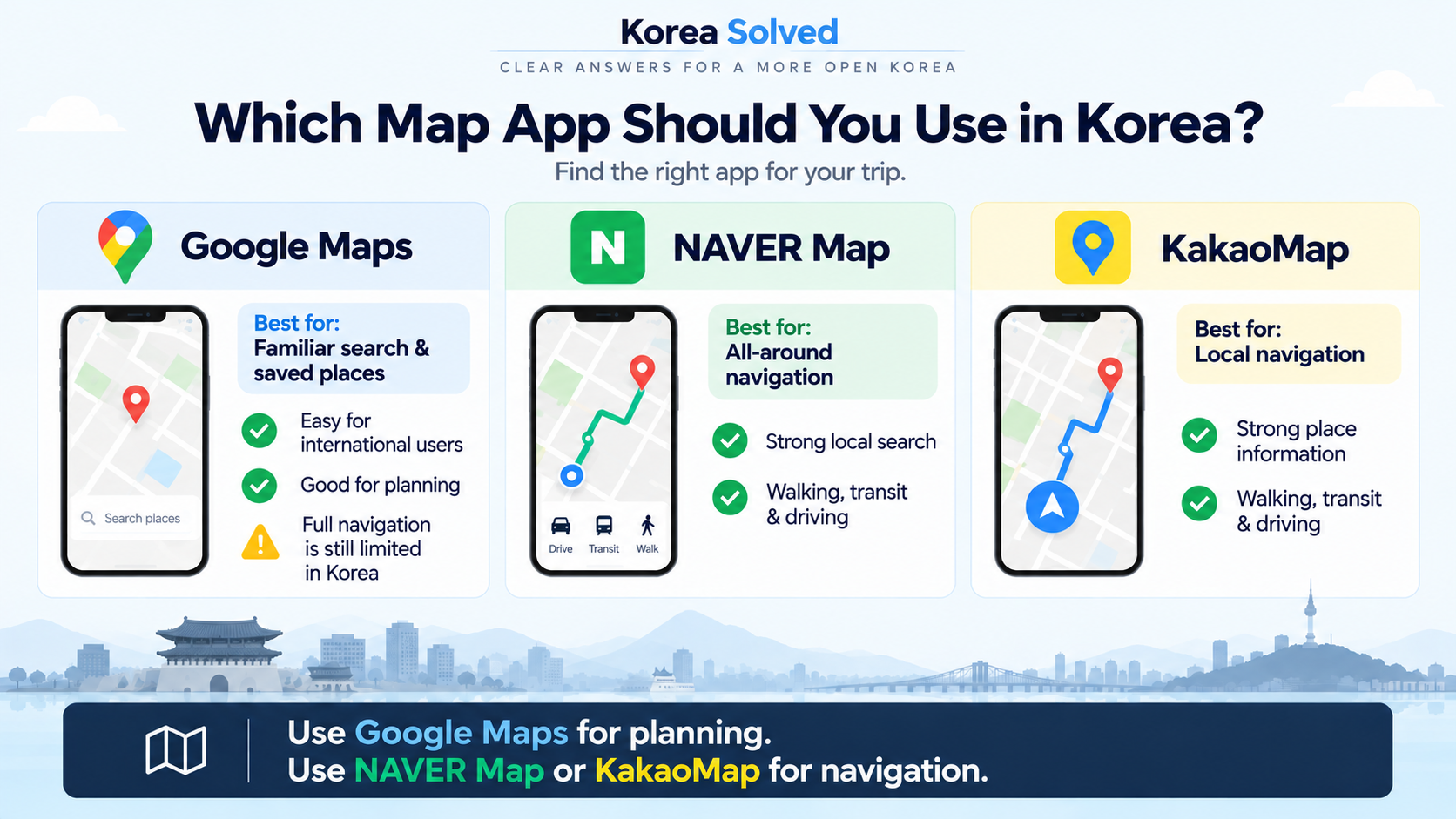
Google Maps vs NAVER Map vs KakaoMap
| Feature | Google Maps | NAVER Map | KakaoMap |
|---|---|---|---|
| Place search | Good | Very strong | Very strong |
| Saved travel places | Excellent | Good | Good |
| Public transit | Available | Excellent | Excellent |
| Walking navigation | More limited than local apps | Yes | Yes |
| Turn-by-turn driving | Still limited in Korea | Yes | Yes |
| English interface | Yes | Yes | Yes |
| Local place information | Mixed | Strong | Strong |
| Best use | Planning & saved places | All-around navigation | Local navigation |
Google Maps in Korea is currently changing, so some features may improve after this article is published.
So How Do I Download and Use NAVER Map or KakaoMap?
That is probably the next question.
Both apps are available on iPhone and Android, but their interfaces and search behavior can feel unfamiliar if you have never used a Korean map app before.
Korea Solved will cover them in separate step-by-step guides:
- How to Download and Use NAVER Map in Korea
- How to Download and Use KakaoMap in Korea
- NAVER Map vs KakaoMap: Which Is Better for Foreigners?
Those guides will cover installation, English settings, place searches, walking directions, public transportation, and common problems foreign visitors run into.
Will Google Maps Eventually Work More Like It Does Elsewhere?
The situation is moving in that direction.
The biggest map-data policy obstacle changed in 2026, and Google has continued working toward expanding its Maps capabilities in Korea.
But travelers should not assume that every Google Maps feature they use at home is already available.
Until full functionality is officially rolled out and proven in everyday use, local map apps remain the more dependable choice for navigation inside Korea.
The Simple Answer
Google Maps does work in Korea.
The confusing part is that showing a map and providing full navigation are different things.
Google already had access to Korean 1:5,000 map data for displaying roads and places.
The historical issue was using that same map data within Google’s global routing infrastructure.
And the map-export rules were not simply rules against Google or foreign companies. The central issue was overseas transfer and handling of covered geographic data.
In 2026, Korea conditionally approved Google’s map-data export request, removing a major policy obstacle.
But the app itself still needs time to catch up.
For now:
Use Google Maps to plan.
Use NAVER Map or KakaoMap to get around.
Last updated: September 2026
Sources
-
Google Korea — Q&A on Google Maps data in South Korea
Google’s explanation of the 1:5,000 national base-map data, TMAP Mobility data used for map display, and why full routing relies on globally distributed data centers. -
Korea Legislation Research Institute / National Law Information Center — Spatial Data Management Act, Article 16
Official Korean law stating that covered basic surveying results, including maps, cannot be exported overseas without permission. The rule applies to “anyone,” not only foreign companies. -
Ministry of Land, Infrastructure and Transport — Conditional approval of Google’s 1:5,000 map-data export
Official government announcement dated February 27, 2026, explaining the conditional approval and security requirements for overseas map-data transfer. -
9to5Google — Google Maps turn-by-turn navigation is coming to South Korea
August 2026 reporting on Google’s plans to bring full turn-by-turn navigation to Korea and the fact that the rollout was still in progress.